Oracle Spatial Studio is a self-service, no-code mapping tool that allows you to visualize, explore, and analyze geospatial data stored in and managed by Oracle. Version 24.2 is now available in the OCI Marketplace and for on-premises deployment. This release provides an array of features to improve usability and functionality. Here are some highlights.
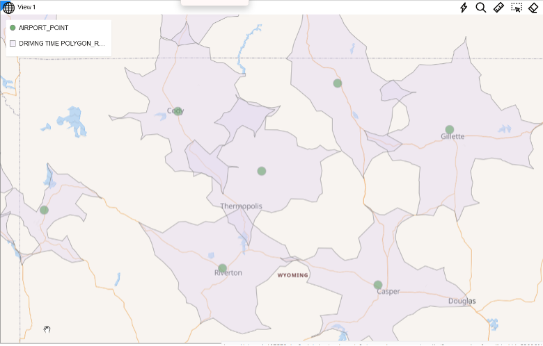
Drive-Time Polygons
We’ve added new spatial analysis support that creates drive time and distance polygons from a set of input locations. This shows the areas that can be reached within a specified distance or time.
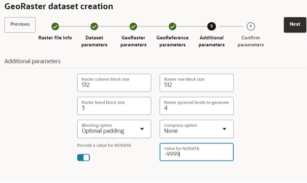
GeoRaster Loader
We’ve also introduced loading of raster files (for example satellite imagery and elevation models) to Oracle Spatial GeoRaster, and optionally creating a corresponding Spatial Studio dataset. Loading is done using a wizard-based UI and requires no coding.
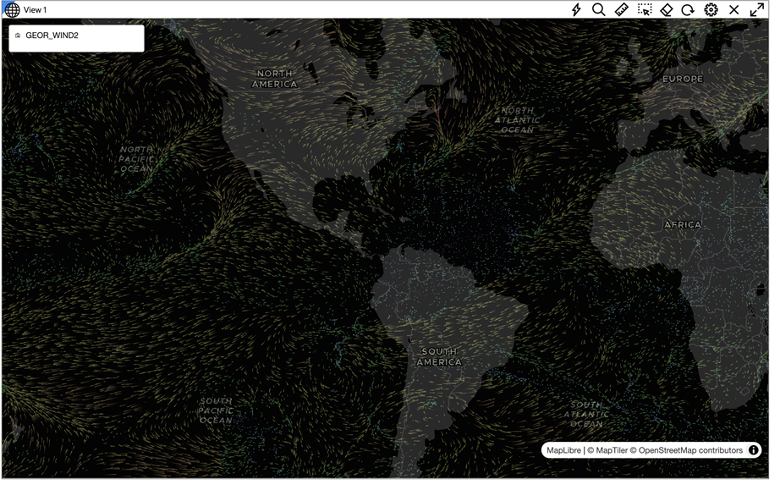
Wind data
Oracle Spatial Studio 24.2 introduces support for visualizing wind flow from rasters that contain wind information. You can create and visualize wind animations that depict the direction of flow between various locations.
Although commonly referred to as wind animation, this visualization applies to any movement-based visualization and can render wind speeds, depict tectonic plate movements, or other vector-based simulations. This can enhance planning use cases, such as wind turbine placement, crop dusting, or geospatial other planning operations.
Notably, this release is supported on Java JDK 11 or later. If you are still using an older JDK version you will need to upgrade.
Want to learn more? Please use these links for our documentation, download information, LiveLab workshops, and more information.