Oracle Spatial Studio is a self-service, no-code web tool that allows you to visualize, explore, and analyze geospatial data stored in and managed by Oracle. Version 25.1 is now available in the OCI Marketplace and for on-premises deployment. This release offers a range of features designed to improve usability and functionality. We’ll outline some highlights here, but you can find the full list of new features in our documentation.
Rendering GeoRaster images with DEM data
We now support rendering of GeoRaster images with Digital Elevation Model (DEM) data as 3D terrains on a map. DEM is typically used to model the terrain elevation of the Earth’s surface.
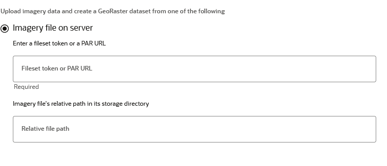
Improvements to the GeoRaster Dataset Creation Wizard
We have added support for uploading images from an Oracle Object Storage bucket to Oracle Spatial GeoRaster. This includes loading to a new GeoRaster table or appending to an existing GeoRaster table.
Color 3D Tiles
This release has two changes regarding color. We now allow rendering of 3D point cloud tiles with color. This allows for data-driven color styling to be applied to 3D point cloud tile visualizations.
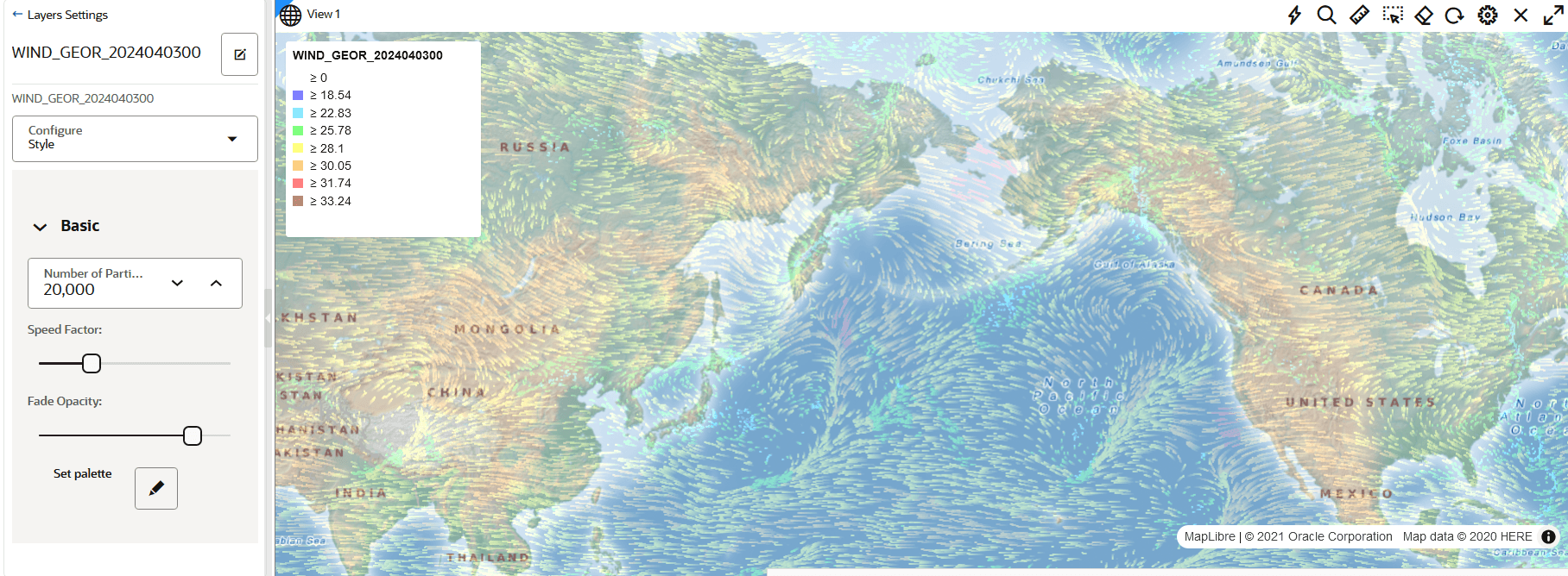
Render wind animation
We also added legend support with a color scheme for various ranges of wind velocity values in the wind animation dataset visualization, allowing you to color-code your data for quicker analysis and impact.
Want to learn more? Please use these links for our documentation, download information, LiveLab workshops, and more information.