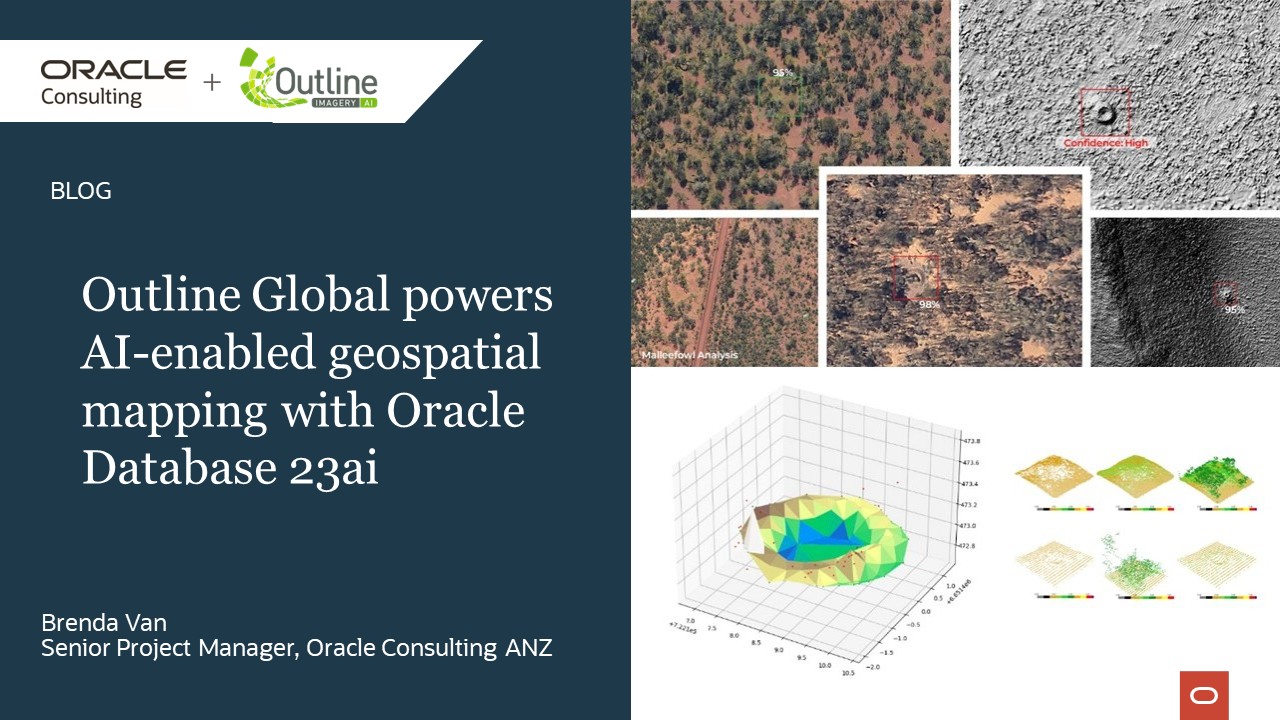
Australian firm leverages AI to deliver data-intensive geospatial insights, transforming petabytes of pixels into sustainable progress and profit.
“Oracle Database… has enabled us to deliver faster, more reliable data and analytics services, helping our customers make critical planning and policy decisions with enhanced geospatial insights. As a result, we’ve seen a 30 percent increase in revenue.” – Kevin Kwok, Head of Growth, Outline Global
Business challenges
Established in 2009, Outline Global delivers critical geospatial data to government agencies and industries such as agriculture, mining, and urban development in Australia.
Outline’s customers use the data to inform operational, investment, planning and policy decisions and to help them meet conservation compliance requirements, model erosion, monitor coastlines, map transport corridors, inspect physical assets and more.
The firm had been using on-premises infrastructure to process and manage its vast spatial data store covering more than 8.5 million square kilometers of imagery. However, the associated time-consuming manual processes limited the firm’s ability to scale and introduced risks. It also made it difficult to integrate advanced features like containerisation, developer extensions, and business intelligence tools.
Outline saw the opportunity to speed time-to-insight for its clients by replacing delivery of information via transfer of large data files with a portal that enabled clients to access and analyse data direct from the cloud.
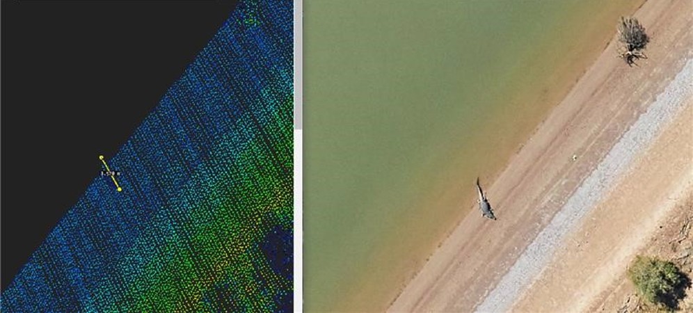
Outline Global captures imagery in such detail that it determined the length of a crocodile that photobombed a mapping exercise to the centimeter (320cm to be exact)
Why Outline Global chose Oracle – and Oracle Consulting
After careful evaluation of options, Outline selected Oracle Database 23ai to streamline its operations and improve the effectiveness, efficiency, and security of managing the petabytes of imagery it has collected. Advantages included geospatial interoperability, scalability, and ability to integrate with business processes.
Outline engaged Oracle Consulting to create an interactive spatial data portal to transform static aerial data into a cloud-native dynamic, connected experience.
Delivered over a seven-month period in conjunction with a third-party mapping partner, the solution included Oracle Autonomous Database, Spatial Services, and Oracle low-code APEX on Oracle Cloud Infrastructure. The project was recognised in the 2025 Oracle Excellence Awards for Applications Innovation on Oracle Database.
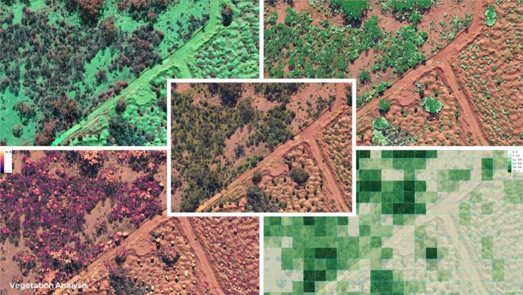
Outline Global uses computer-vision, machine learning and AI deep learning models to fuse complex spectral relationships to monitor and report on vegetation health and land rehabilitation actions
Results
The real-time Spatial Vector Search capabilities in Oracle Autonomous Database have enabled Outline to transform its workflows and handle large-scale geospatial data more effectively.
“Integrating ground-breaking innovative technologies to deliver data-intensive geospatial insights is the cornerstone of our business strategy and enables us to stay ahead of the competition,” says Kevin Kwok, Head of Growth, Outline Global.
Oracle Database 23ai with AI Vector Search has been a game-changer. It has enabled us to deliver faster, more reliable data and analytics services, which has helped our customers to make critical planning and policy decisions with enhanced geospatial insights. As a result, we’ve seen a 30 percent increase in revenue and 50 percent growth in our lead generation pipeline.
With Oracle’s Spatial Vector Search capabilities, Outline’s customers can now search through complex spatial images and relational data based on conceptual content, and not just a set of predefined Xarray of pixels or data values. This breakthrough significantly simplifies the search process and provides more accurate and relevant results.
By leveraging large language models (LLMs), customers can retrieve spatial data—whether 2D, 3D, or other complex datasets—using a natural language interface, making it easier to access and analyse the data they need.
Additionally, by storing and processing both business and vector data within Oracle Database 23ai, Outline can innovate without compromising data security by seamlessly integrating Spatial Vector Search into new and existing business applications. Avoiding data movement from a specialised vector database to another general-purpose database also eliminates data fragmentation challenges that can arise in AI workloads.
“Our Oracle Database implementation has reduced our data administration time by approximately 20 hours per week. It has streamlined the data transfer and ingestion process by connecting Oracle Database directly to our data transfer facilities connected to where our aircraft are parked. It has materially removed the risks of physical hard disks and accelerated our back-up workflow by 200%,” reflects Kevin.
“Oracle Database enables us to serve our aerial imagery and geospatial content directly to our clients’ applications. It simplified our data ETL (extract, transform, load) procedures with its in-built functions, and helped us with time-sensitive data reporting by integrating directly to an APEX front-end dashboard.”
Oracle Consulting ANZ Delivery Director, Amit Dua, says the collaboration showcases what’s possible when bold ambition meets the right technology and delivery partner.
“Outline Global challenged us at Oracle Consulting to reimagine how AI, spatial data, and cloud-native technologies could converge to deliver next-gen geospatial intelligence at scale. This wasn’t just about migrating to Oracle Database 23ai; it was about unlocking new business value from petabytes of aerial imagery. By combining Spatial Vector Search, Spatial Services, and Oracle APEX into a seamless architecture, we helped turn static data into a dynamic decision-making engine,” says Amit.
“Many customers are drawn to Oracle’s Fusion applications for their embedded AI. However, Oracle Consulting can deliver bespoke AI solutions where standard solutions are not suitable,” says Amit. “This can include public sector, mining and geo-spatial specialist customers with complex legacy systems, strict compliance requirements and highly specialised workflows with spatial imagery processing – enabling them to drive automation, improve decision-making, and unlock value.”
AI to the rescue: conserving the elusive Malleefowl
Outline Global’s AI-powered geospatial imagery is helping mining companies to meet conservation compliance requirements and protect the vulnerable Malleefowl, one of Australia’s hardest-working but most elusive birds.
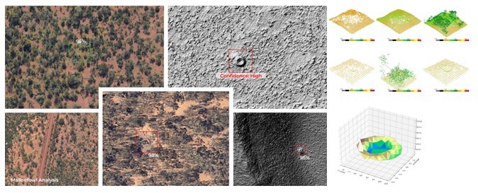 Malleefowl are about the same size as a chicken, and keep a low profile, so the key to protecting them is to identify their giant nesting mounds. The nesting mounds are not easy to identify at scale, despite measuring four-plus meters across. They are too widely scattered to find by drone and too well camouflaged by vegetation for satellite detection while ground surveys are very expensive and time consuming.
Enter Outline Global, which uses AI on Oracle Database 23ai to identify Malleefowl nests by combining aerial imagery and LiDAR data with geospatial and computer vision techniques to train a sophisticated detection model.This helps experts to prioritise locations to review on the ground, making the process more efficient and accurate.
About the customer
Outline Global is Australia’s choice for premium quality geospatial imagery, LiDAR and location based artificial intelligence (AI), delivering data-intensive geospatial insights.