Oracle Spatial Studio is a self-service application for easy access to the spatial features of Oracle Database. Spatial Studio handles spatial data access, analysis, and visualization, without the need to write code. Users often need to access spatial analysis results outside of the Spatial Studio application. For this purpose, Spatial Studio provides several options.
1. Save analysis as view or table
Beginning with Spatial Studio 21.1, analyses may be saved as a database view or table. This is valuable for scenarios such as Oracle Analytics Cloud (OAC) and other applications accessing Spatial Studio results directly from tables and views.
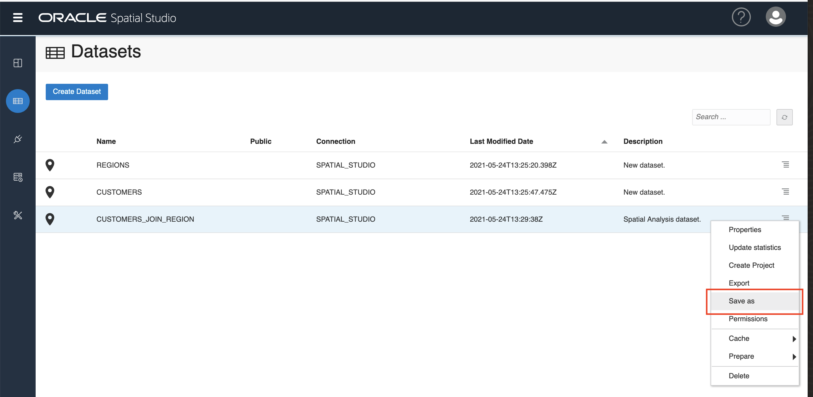
Note: Prior to Spatial Studio 21.1, analyses were stored as database views and Spatial Studio allowed users to create friendly synonyms for those analysis views. Starting with Spatial Studio 21.1, analyses are stored in Spatial Studio’s metadata repository. The “Save as” feature effectively replaces creating a synonym for an analysis.
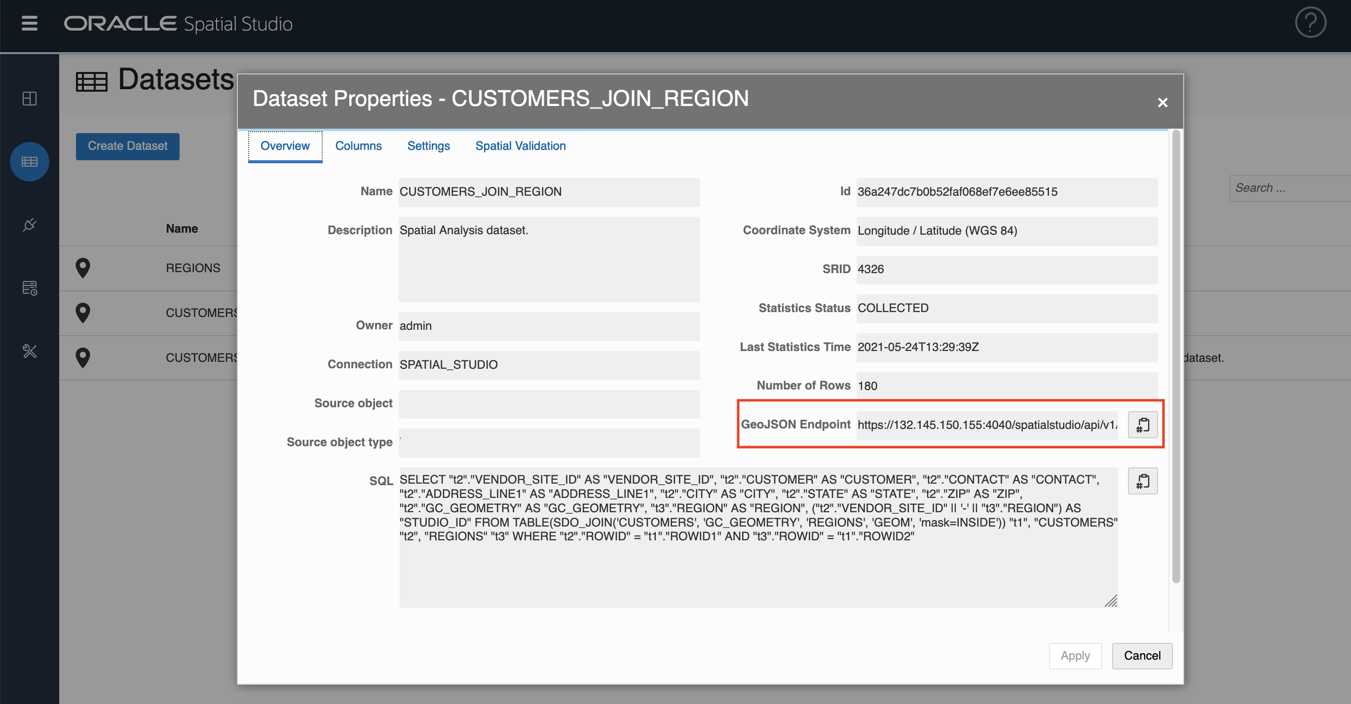
2. GeoJSON endpointAs with previous versions of Spatial Studio, analysis results are accessible from the auto-generated GeoJSON endpoint displayed in the Properties dialog.
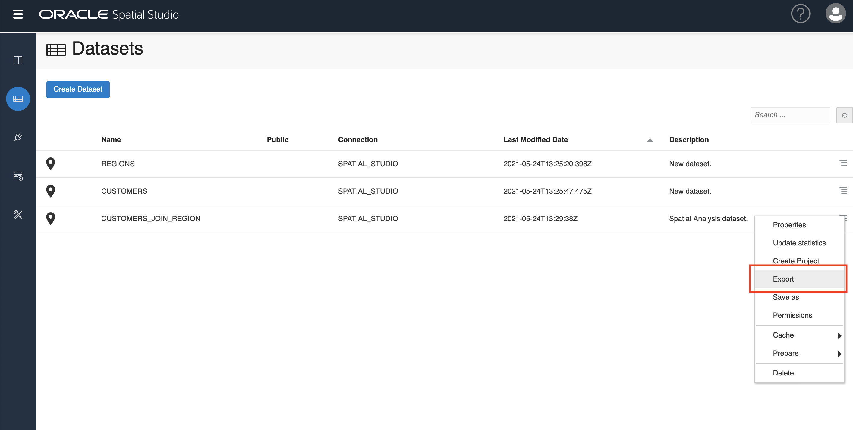
3. Export > Import
Also as in previous versions of Spatial Studio, analyses may be exported GeoJSON (or CSV) so that they can be imported to another application.