We’re pleased to announce the release of Oracle Spatial Studio 22.3. Oracle Spatial Studio is a no-code web tool for working with the Spatial features of Oracle Database. This blog post will explore some of the new functionality available in this release. For general information about Spatial Studio and to get started, please click here.
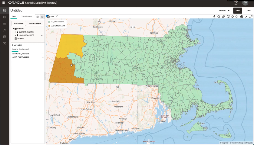
Streamlined Creation of Custom Regions
Groups of existing regions may be combined into customer regions. Spatial Studio now streamlines the process by automatically creating a new table and dataset for the custom regions.
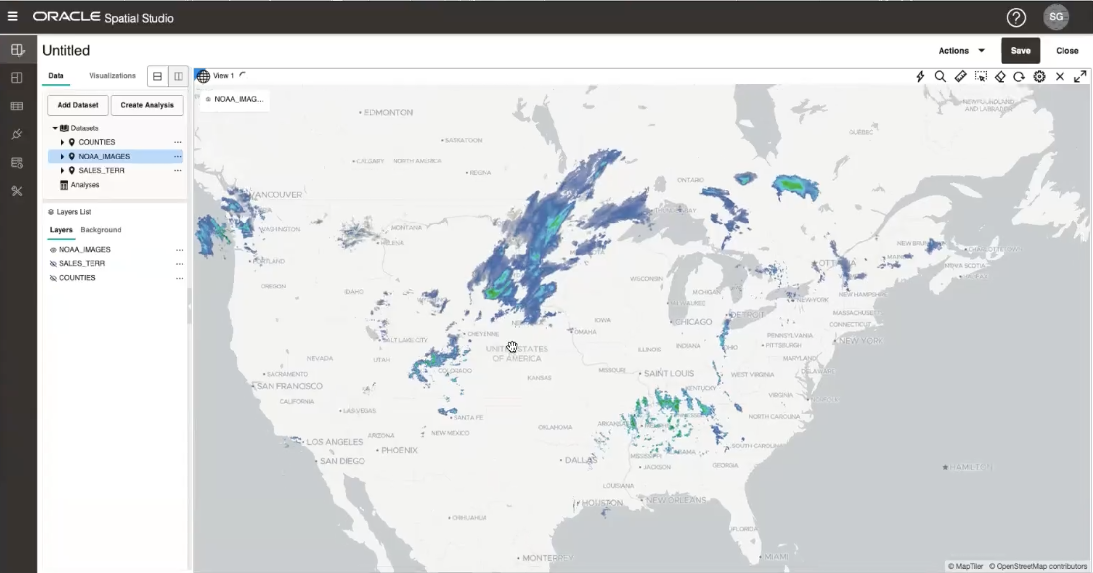
Dataset from OGC Web Map Service (WMS)
Users can now create a dataset from a WMS and include it as a layer in a map. Previously, Spatial Studio only supported WMS as a basemap.
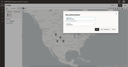
Saved Pins for Use in Analysis
You can now drop multiple pins on a map and save them as a dataset. These saved pins can then be used like any other dataset for visualization and analysis.
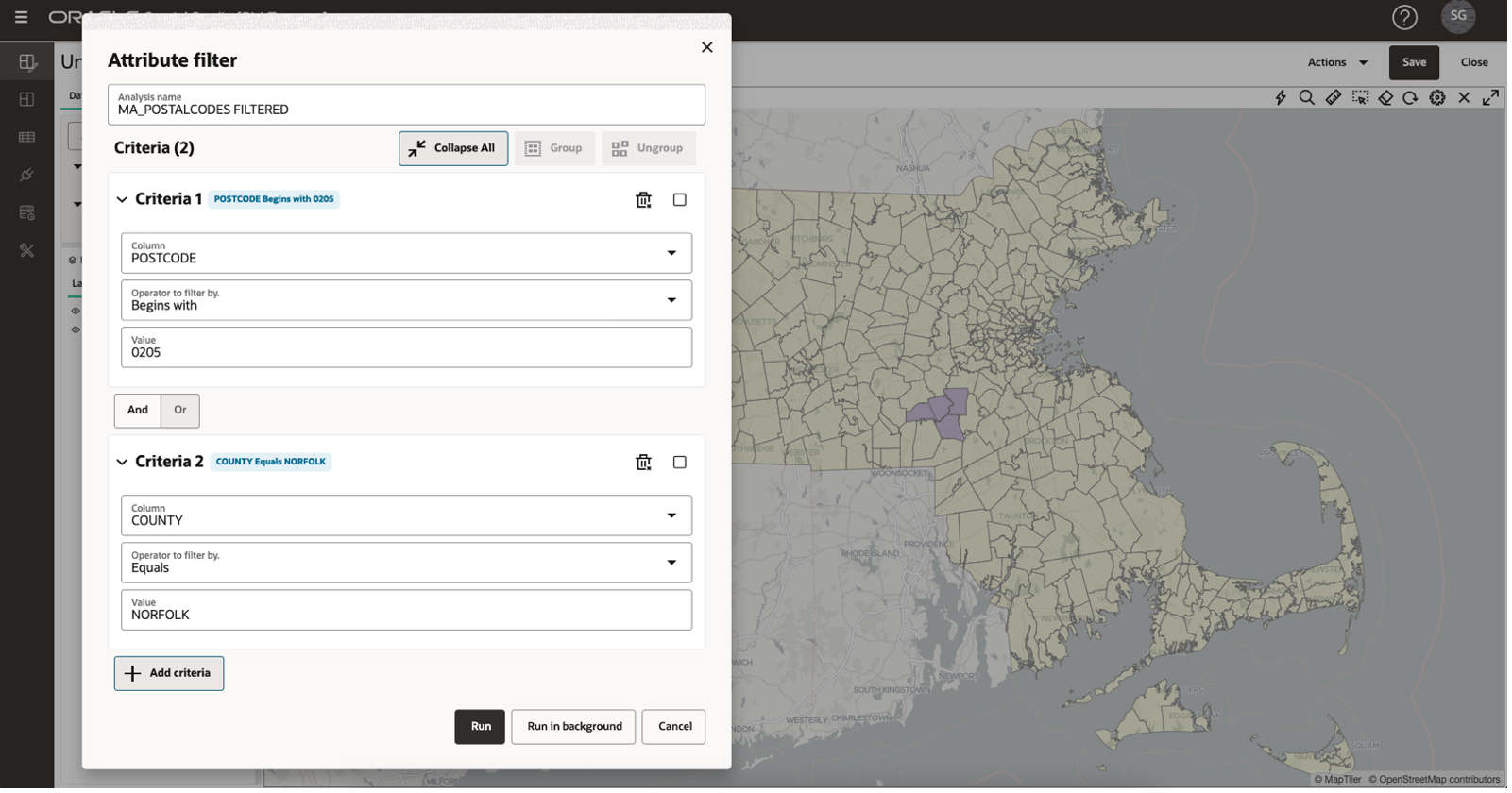
Compound Non-Spatial Filter Criteria
Spatial Studio 22.3 adds the ability to define multiple criteria for a non-spatial filter analysis.
To deploy to Oracle Cloud, please visit the Oracle Cloud Marketplace and search for Spatial Studio, or to download, please visit Oracle Spatial Studio Downloads.