Oracle Spatial Studio is a no-code web tool for working with the Spatial features of Oracle Database. For general information about Spatial Studio and to get started, please click here. The latest release, Oracle Spatial Studio 22.1, introduces important new capabilities. In this post we explore several of these new capabilities.
Modify Analysis Parameters
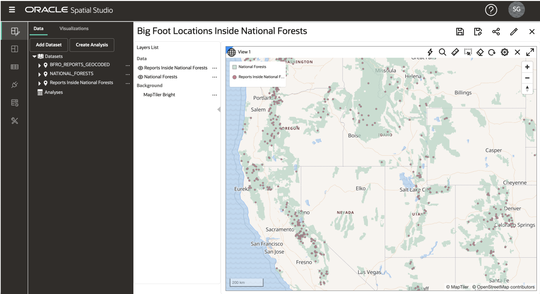
After creating analyses in Spatial Studio, you may now go back and adjust the analysis parameters. Analyses that include modifiable parameters (such as search distance or measurement units) now include a menu option called Modify Parameters. For example, after creating an analysis of Big Foot sightings within 100 miles of a National Forest, you may modify the distance parameter to 200 miles and the results will dynamically update in any maps and tables in your project.
Create Datasets from External GeoJSON URLs
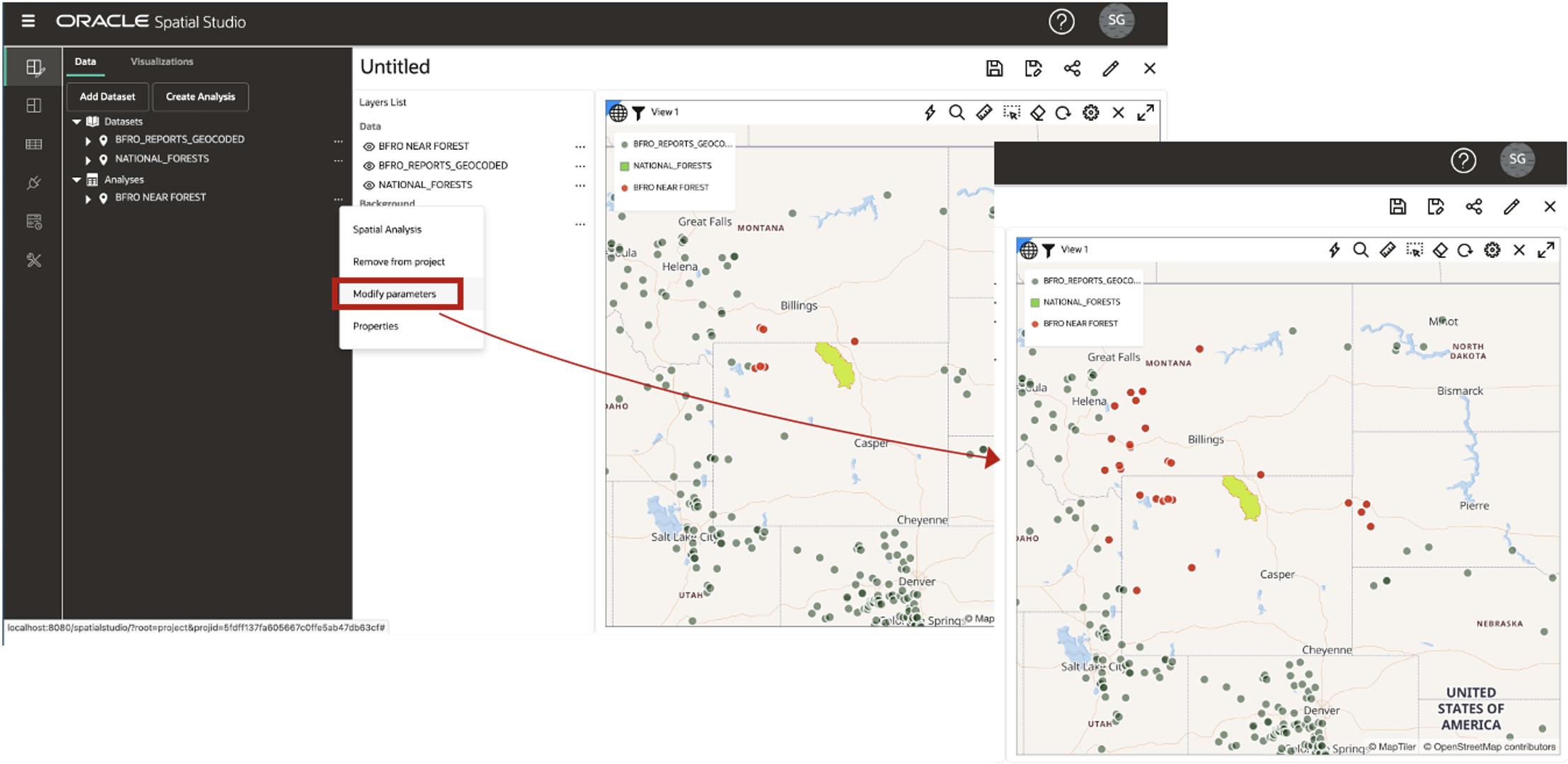
There are an ever-growing number of resources for accessing public domain data. Many of these resources provide access to public geospatial data through a URL that returns GeoJSON. You may now view such data in Spatial Studio directly from its source, without the need to load the data into Oracle Database. The only requirement is that the URL must be reachable by the Spatial Studio server. You simply create a dataset based on a URL that returns GeoJSON. In the example below we access urban areas as GeoJSON from a dataset available at http://geojson.xyz/.
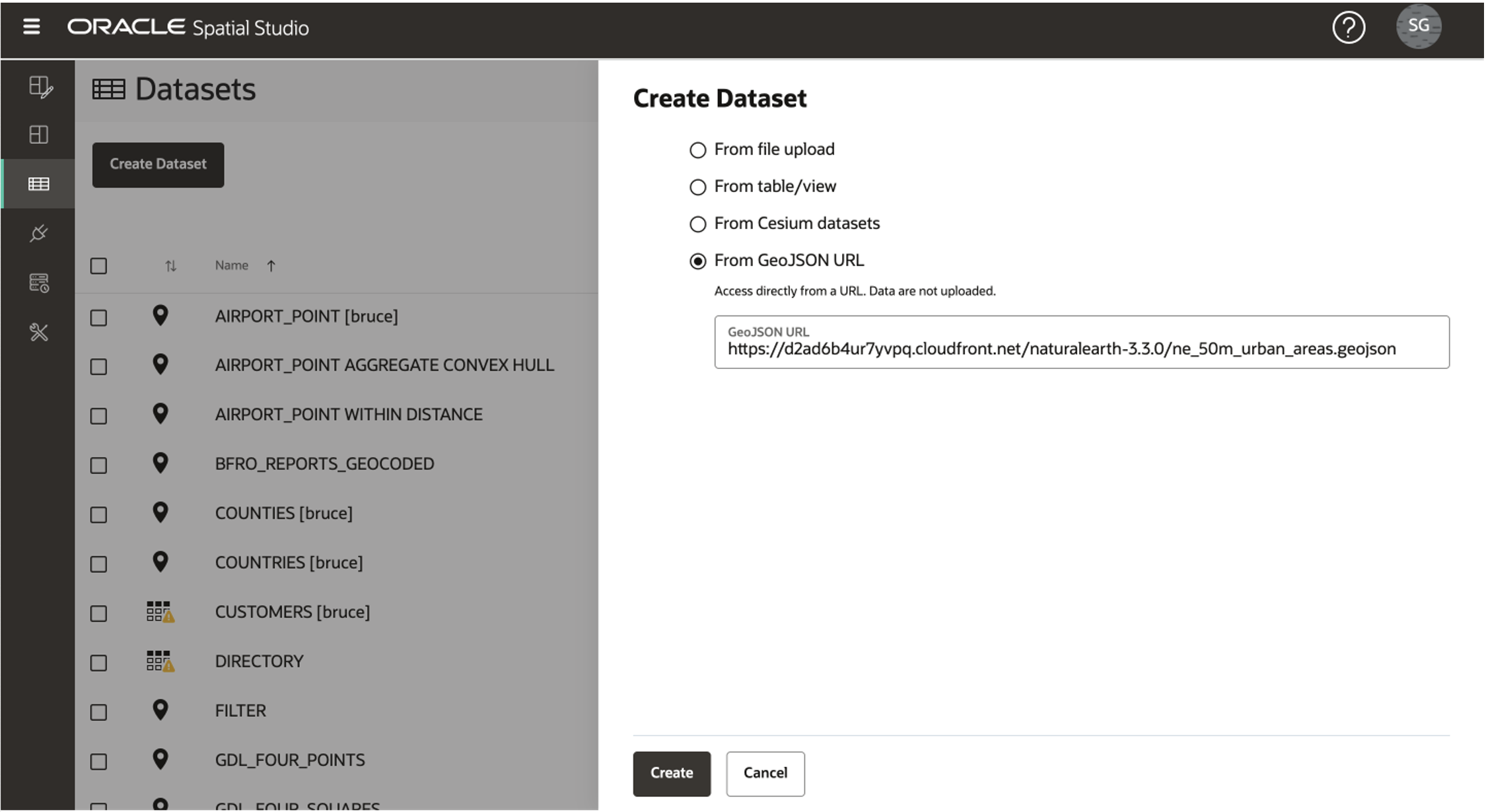
The resulting dataset may then be rendered together with any other Spatial Studio datasets.
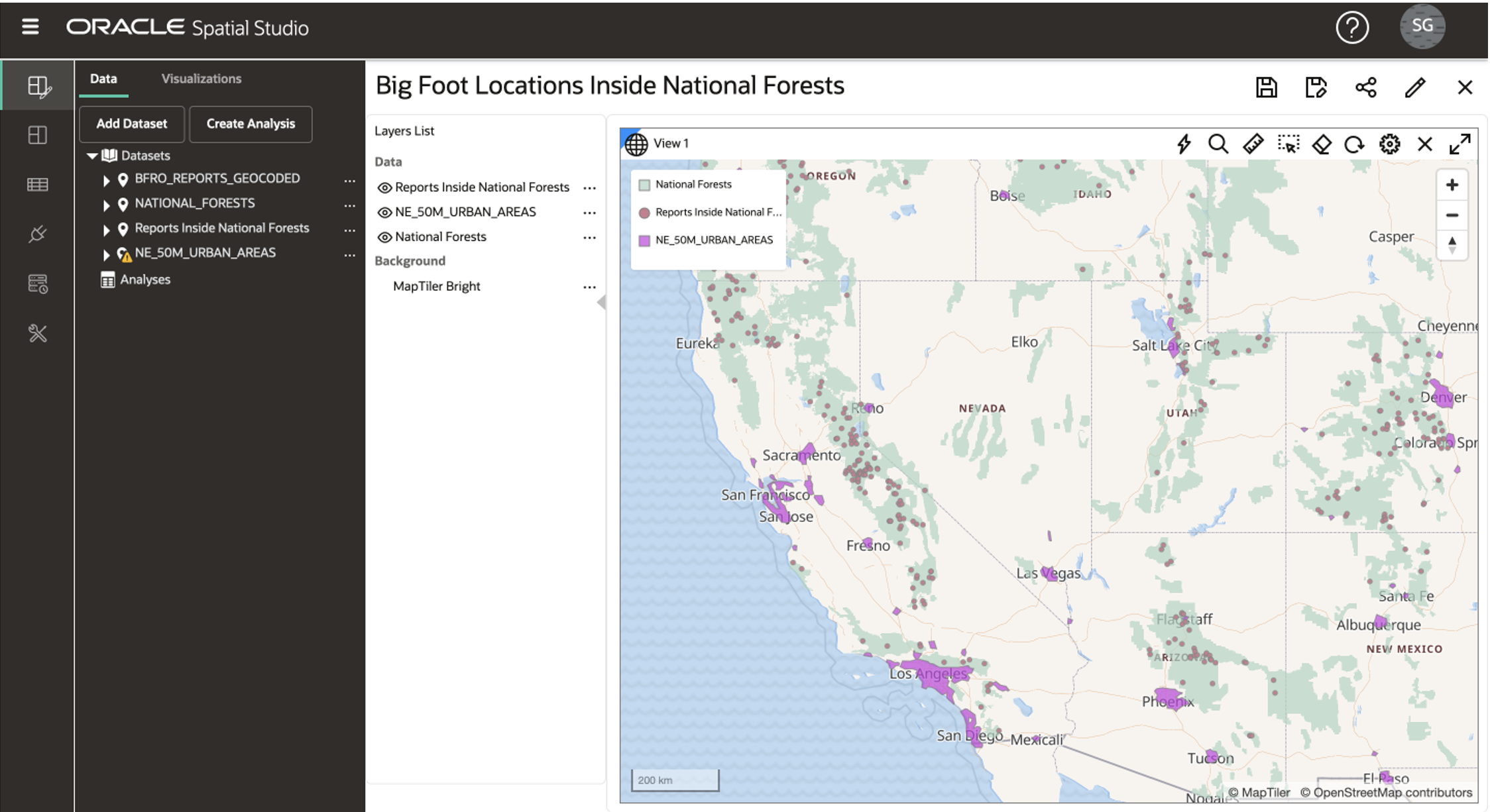
Note that to interact with the layer, it must have a unique column configured as the dataset key. In the example above, there is no key in the GeoJSON so it is available for display only. Also, for technically savvy users, if the GeoJSON endpoint supports CORS, then its domain should be added to Spatial Studio’s Safe Domains for optimal performance. This is done on Spatial Studio’s Administration page.
Animate Moving Objects in Maps
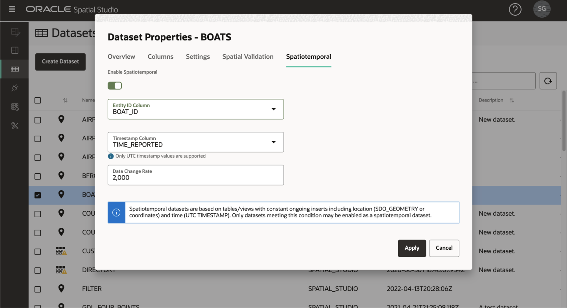
With the proliferation of real-time location-based data collected by sensors, IoT, and devices, there are a growing number of use cases to visualize moving objects. The visualization of the movement of a fleet of vehicles, shipping containers on boats, or rail traffic, all in the context of other mapped features such as hazard zones is of increased importance. To support this, Spatial Studio now allows a dataset to be configured as “Spatiotemporal” which can then be visualized with animation. Spatiotemporal datasets are sourced from Oracle Database where the content is continually updated from a real-time source such as a Kafka stream. To be configured as spatiotemporal, a dataset must include a unique value for each record, a geometry or longitude/latitude index, and a TIMESTAMP column based on UTC. With those conditions met, a dataset can be configured as spatiotemporal.
In the example below, a table called BOATS is being continually updated by a streaming source. The data meets the requirements listed above so it can be configured as spatiotemporal.
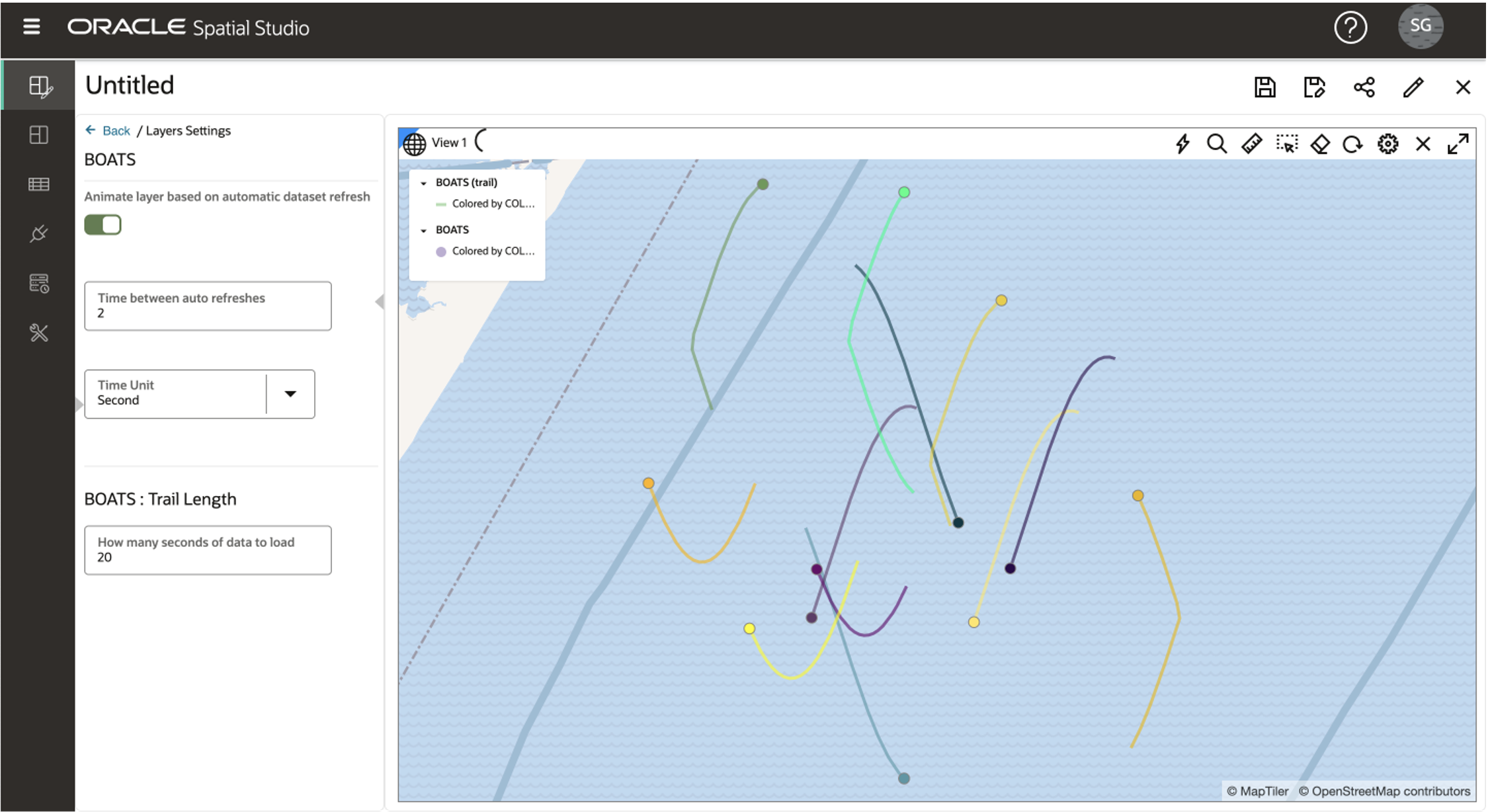
The dataset can then be added to map and visualized with animation including configurable tracks showing the trailing path.
Visualize 3D Spatiotemporal Data from CZML Format
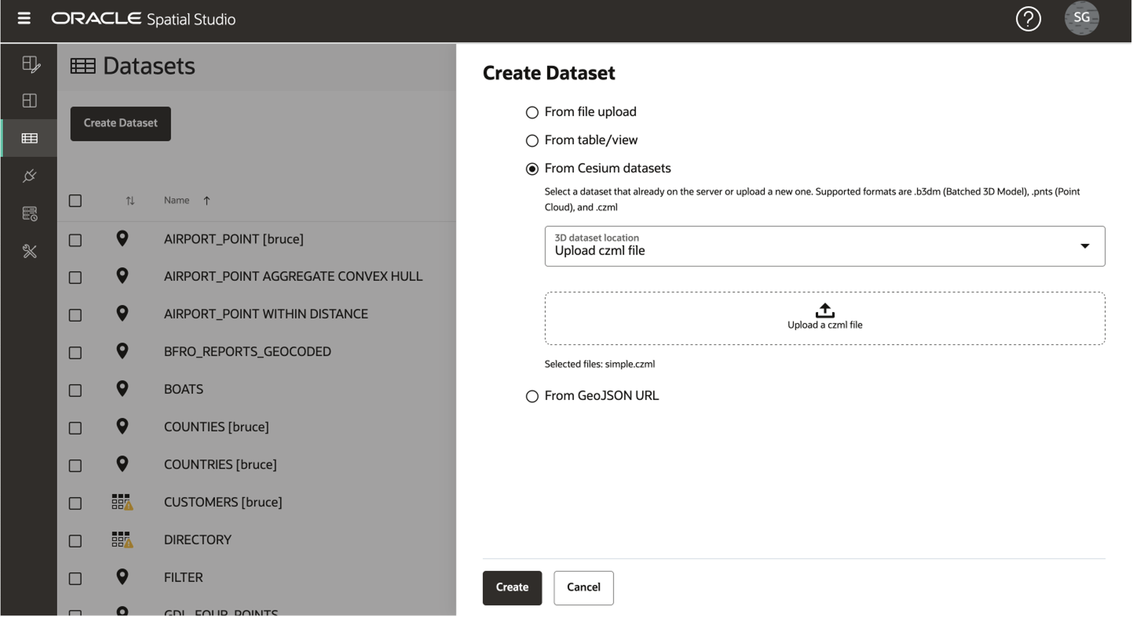
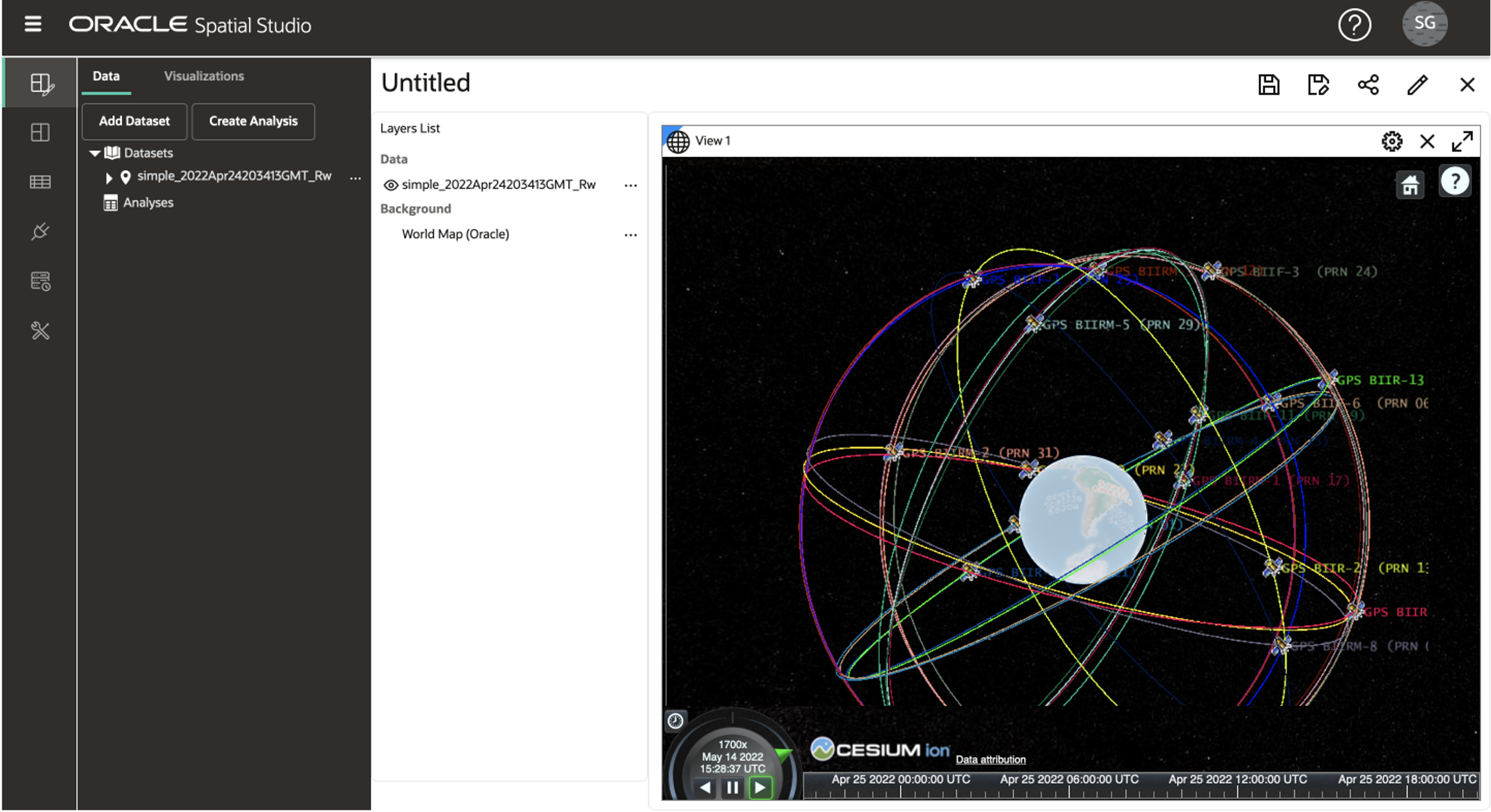
Cesium is a popular and powerful open-source platform for 3D map and globe visualization. Back in December 2020, Spatial Studio 20.1 added support for Cesium maps rendering 3D tilesets from point cloud (pnts) and batched 3D model (b3dm) formats. Spatial Studio 22.1 now adds support for CZML, which is Cesium’s format for “time-dynamic graphical scene”, i.e., 3D geospatial data changing with time. To visualize CZML in Spatial Studio, you first create a dataset.
Then drag and drop onto a Cesium map.
Authenticate using Oracle Identify Cloud Service (IDCS)
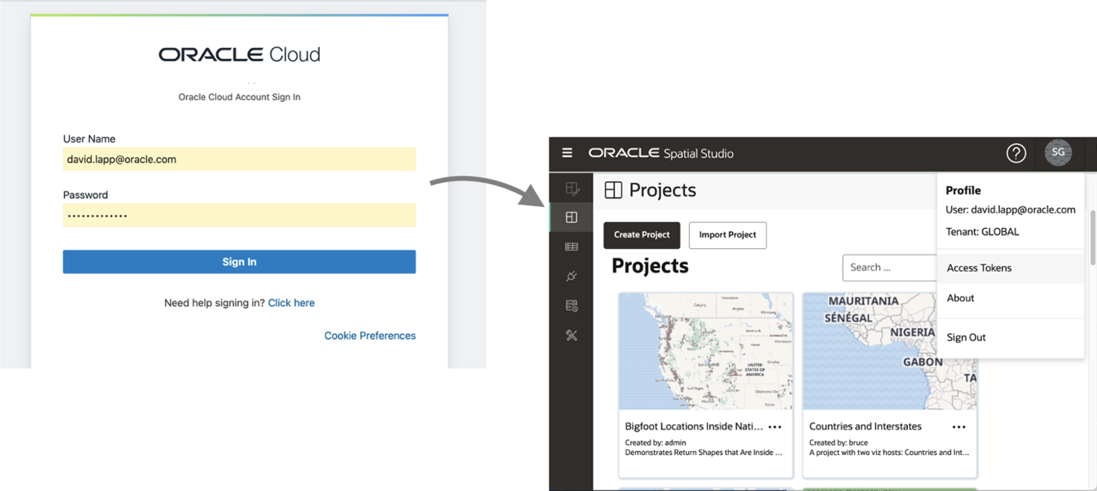
You are now able to configure Spatial Studio to use Oracle IDCS as its identity provider. This integrates Spatial Studio with Oracle’s centralized identity management and single sign-on (SSO) provider for cloud, on-premise, and mobile applications. The configuration is documented here.
Once configured, Spatial Studio automatically redirects to IDCS for authentication and then returns to Spatial Studio.
The complete list of changes in Spatial Studio 22.1 can be found here. We hope these new features and fixes enhance your experience with Spatial Studio. Please reach out with questions and comments through our Spatial Studio Community Forum.
