Oracle Spatial Studio is a self-service, no-code mapping tool that allows you to visualize, explore, and analyze geospatial data stored in and managed by Oracle. Version 23.1 is now available in the OCI Marketplace and for on-premises deployment. This release provides an array of features to improve usability and functionality. Here are some highlights.
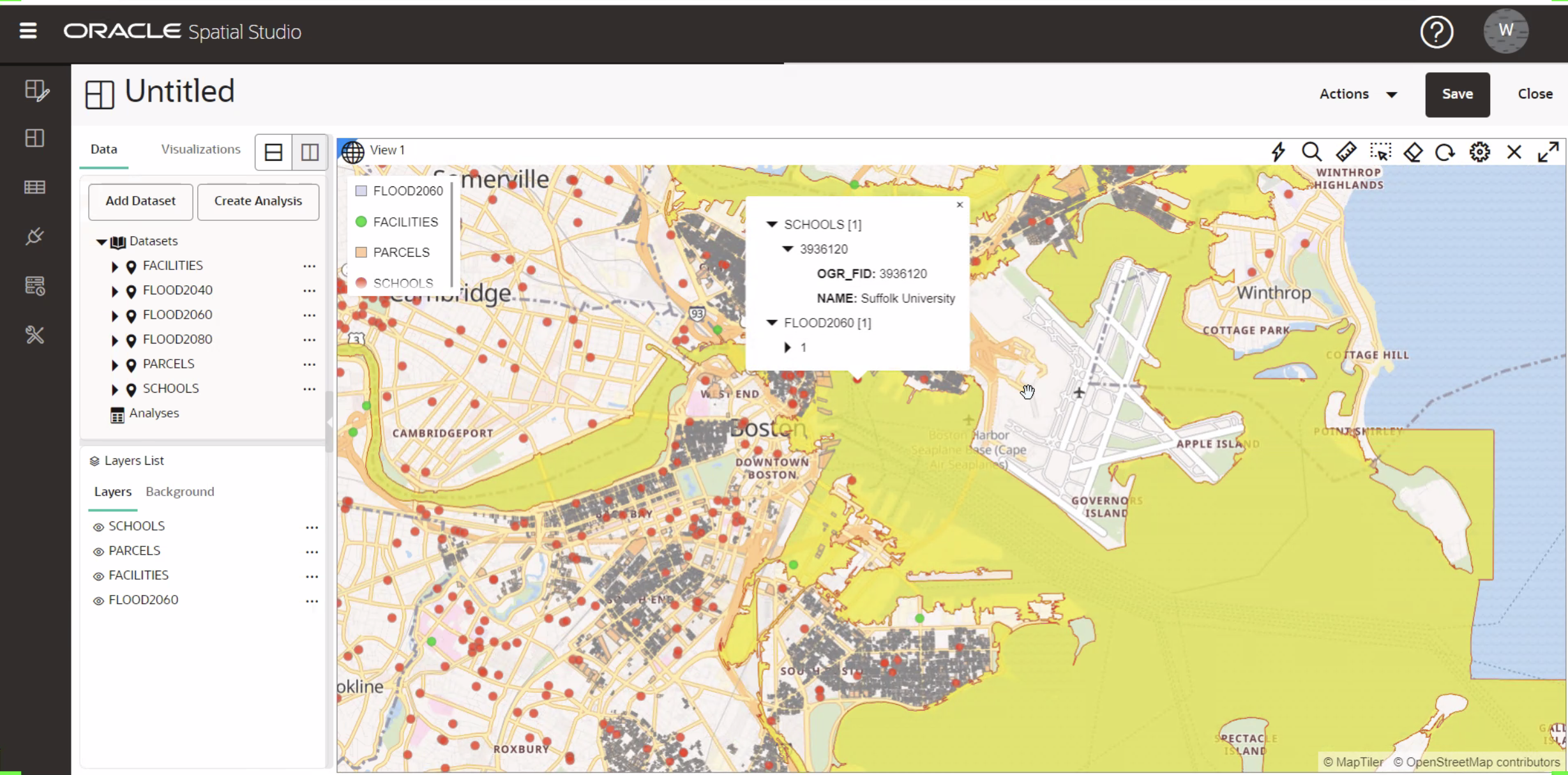
Enhanced Display Capabilities for Overlapping Data Points
Before release 23.1, if map layers overlapped at a specified location, selecting your desired data point could be challenging without hiding the layers containing data at the same point. In 23.1, we enhanced the info window to display attributes for all overlapping map features.
Importing WKT and GeoJSON Text Values in CSV and Excel Spreadsheets
In this release, we added support for importing CSV and Excel spreadsheets containing a column with geometry as WKT (well-known text) or GeoJSON. This data is parsed and stored as SDO_GEOMETRY in the Oracle database.
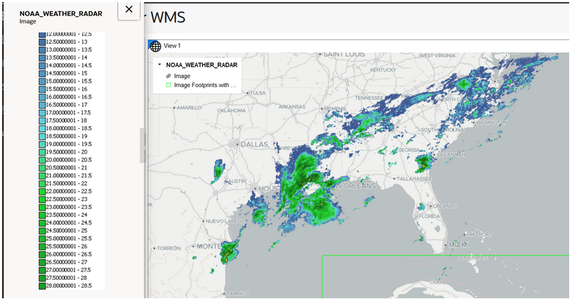
Viewing OGC WMS Dataset Legends
When OGC (Open Geospatial Consortium) WMS (Web Map Service) datasets are visualized on a map, the external map’s legend is often also available. To view the legend information generated by the WMS service, click the Image link on the map legend to view.
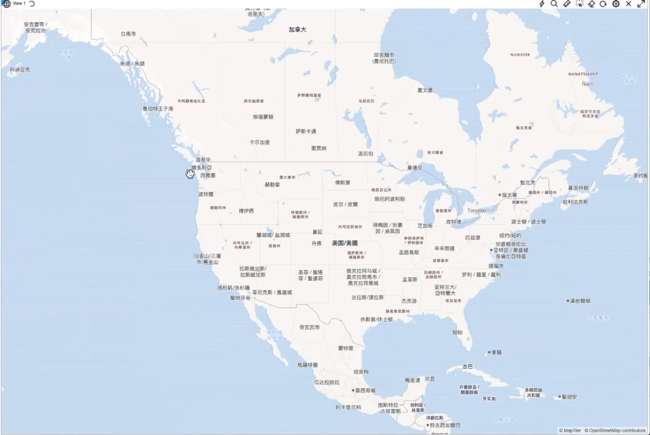
Displaying Vector Tile Basemap Labels in Different Languages
You are now able to select the language for labels in vector tile basemaps. This functionality depends on the translation data provided by the data provider (e.g., OpenStreetMap) for each specific language.
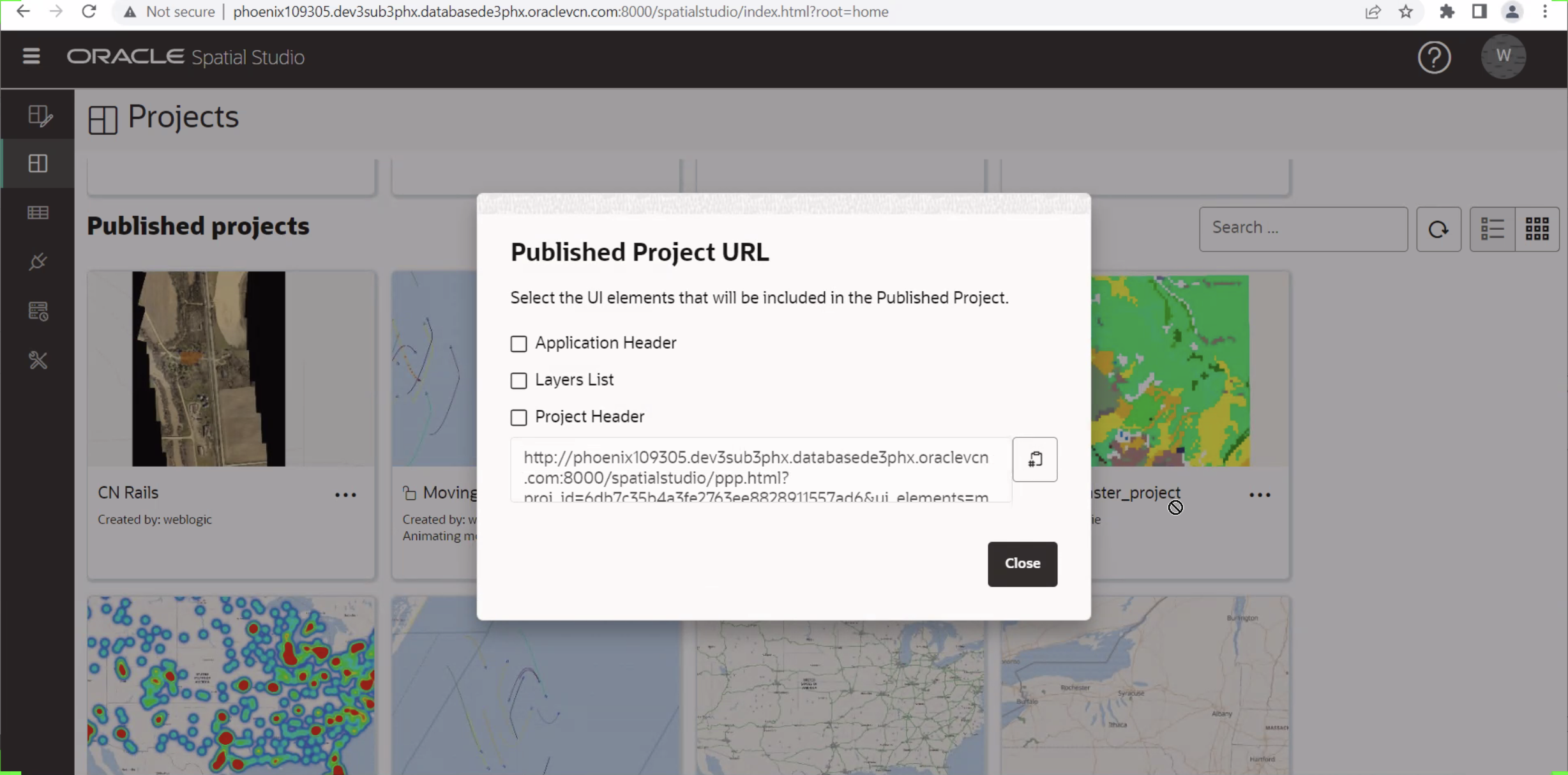
Embedding Public Published Projects in External Web Applications
A public published project can now more easily be embedded in external web applications. You can copy the URL and use this URL in your APEX applications or display the project standalone outside of Spatial Studio.
Additional Information
This release also includes bug fixes resulting in higher quality and stability for Spatial Studio users.
For more information about some of the other new features in Spatial Studio 23.1, please see the Release Notes. Check out our video highlighting some of our new features.